Skip to content
ONE PROPERTY. ONE REVIEWED MEMO.

Kill the wrong sites early. Advance the one that earns the spend.

For development teams deciding where the next diligence dollar goes. Give us an address, a parcel, or the boundary you draw. You get a reviewed, source-cited site memo — a one-time recommendation to advance, hold, or kill — with an accepted-submission delivery window. We confirm the delivery window when we accept your completed property submission. Complex or thin-record sites may require more research. Whether the next $50K–$260K of per-site diligence — counsel, civil, utility, consultants — is worth spending, answered before you spend it.

The cheap no belongs before the expensive maybe.

We provision access and invoice directly. Once invited, you submit the property and complete intake in your workspace.

ONE ADDRESS IN. THIS DOCUMENT OUT. · WORKED EXAMPLE
RealClearWORKED EXAMPLE
SOURCE-CITED SITE MEMO · FIRST-PASS SITE DECISION
Ashburn Expansion
Data center · 72 acres · Loudoun County, VA
HoldAsk Utility · Ask Counsel
54
Feasibility score / 100
The recommendation is the answer; the score is context.
WORKED EXAMPLE · REVIEWED MEMO47 SOURCE DOCUMENTS · EVERY PERSISTED CLAIM CHECKED AGAINST ITS CITED SOURCENOT LEGAL ADVICE · VERIFY INDEPENDENTLY
RealClearWORKED EXAMPLE
02 · CONTENTS
01Recommendation — Hold1
02Site & submission2
03Zoning path3
04Power + permission4
05Community posture5
06Comparable outcomes6
07Risk register7
12Source appendix12
EVERY SECTION OPENS TO ITS SOURCES
RealClearWORKED EXAMPLE
07 · RISK REGISTER — EVERY ROW SOURCE-LINKED
Zoning pathPUBLIC-RECORD VERIFIED
Power + permissionCONSULTANT-NEEDED
Community posturePUBLIC-RECORD VERIFIED
Civil / traffic fitNEVER INFERRED
FULL REGISTER SHOWN IN 01 · HOW IT GETS MADE BELOW
RealClearWORKED EXAMPLE
12 · SOURCE APPENDIX — SHOWING 12 OF 47 DOCUMENTS
ORDINANCELoudoun County Zoning Ordinance — district map + use table
MINUTESPlanning-commission hearing — session one, on the record
MINUTESPlanning-commission hearing — session two, on the record
UTILITYElectric-utility service-territory filing for the parcel
COMPARABLES220+ researched entitlement fights, ranked by similarity
GAPAvailable MW — flagged as a gap, never guessed
…and 35 more on file.
EVERY DOCUMENT RETRIEVABLE FROM THE MEMO
Showing the cover page of the worked-example memo.

Request access SUBMIT ONE SITE — WE RESEARCH, REVIEW, AND DELIVER THE MEMO

01 · HOW IT GETS MADE

How that document gets made. One research run, start to finish.

What you're looking atThe worked example from the memo above — a 72-acre data-center site in Loudoun County, VA — taken through the four stages that produce it. Choose a stage to follow the run.
SITE PACKET · WORKED EXAMPLE1
Ashburn Expansion
Data center · 72 acres · Loudoun County, VA
Parcel
buyer-provided
Intended use
data center
Scale
120MW target
Deal file
as-is

1.Three fields — where, what, how big — plus an optional parcel. Scale is vertical-specific: megawatts for a data center, units for multifamily, square feet for retail.

How to read thisEach chip is a source document pulled for this site — a sampling of the 47 on file. A dashed chip is a flagged gap — something the record does not show, listed rather than guessed.
RECORD PULL · COUNTY + STATE + FEDERAL LAYERSWORKED EXAMPLE
ORDINANCE · zoning district + use tableMINUTES · two recent hearings, water + noise objectionsUTILITY · service territory filingCOMPARABLES · 220+ researched fightsGAP · available MW — flagged, not guessed
47 SOURCE DOCUMENTS ON FILE — THIS SITE

2.A jurisdiction we haven't deep-mapped yet is never rejected — an unmatched address triggers its own dedicated research run before the memo is written.

RISK REGISTER · THE WORKED EXAMPLEEVERY ROW SOURCE-LINKED
Zoning pathCUP path identified with planning commission hearing.Ask counsel to confirm appeal exposure.Loudoun County Zoning Ordinance · permitted-use tablePUBLIC-RECORD VERIFIED
Power + permissionService territory is cited; available MW is not inferred.Ask utility for capacity, queue, upgrades.Electric-utility service-territory filingCONSULTANT-NEEDED
Community postureTwo recent hearings show water and noise objections.Plan outreach before first filing.Planning-commission hearing minutes ×2PUBLIC-RECORD VERIFIED
Civil / traffic fitParcel size does not prove access, stacking, or turning.Ask civil and traffic to test layout.Not in the record — hand-off to civil + trafficNEVER INFERRED

3.The citation gate is mechanical: a claim without a cited source is blocked from delivery, and a failed check on a claim the recommendation depends on blocks the whole memo.

4.The recommendation is computed from the cited risk register, with a guard that keeps the score and the recommendation consistent.

✳ analyst's note — power adjacency is not power availability; the memo hands that question to the utility, on the record.

The whole product, one sentence

“You give us a site. We read the public record. You get a reviewed memo with a recommendation — and every claim carries its source. A memo that can't, doesn't ship.”

Your Loudoun site and your Phoenix site: read the same way, to the same standard, every time. The screening read that costs your team days per candidate — delivered as a document, with the sources attached. We confirm the delivery window when we accept your completed property submission. Complex or thin-record sites may require more research.

CANDIDATE SITE · THE RECORD PULL

An address becomes a site.

The run begins in the public record — the rules, the hearings, and the history that already act on this land.

02 · HOW TO READ IT

Three words. Read the band, not the number.

Advance · Hold · Kill. One of these three words leads every memo.

54
Feasibility score / 100
Computed from the cited risk register.
Advance
The record supports the next diligence dollar. Proceed to LOI-stage questions with the cited path in hand.
Hold
Do not spend yet. Named professional questions must come back first — utility, counsel, civil, or the local team.
Kill
The record already shows the deal killer. The cheap no, delivered before the expensive maybe.
WHAT STOPS A MEMO FROM SHIPPING
MISSING CONTROLLING EVIDENCEUNCITED CLAIMFAILED CITED-SOURCE CHECK

A memo that cannot stand behind its recommendation doesn't ship. Before delivery, every persisted claim is checked against its cited source. Load-bearing failures are held or removed.

The recommendation is never written first and justified after.

03 · WHERE IT LIVES

The memo is the deliverable. The workspace is where it lives.

What you're looking atThe site workspace your team gets — every tab, every claim, sourced. Shown with the worked example. The tabs are clickable.
PORTFOLIO / ASHBURN EXPANSION / RISK REGISTERWORKED EXAMPLE · TRY THE TABS · OPEN THE CITATION
OverviewThe site, at a glance
HoldAsk Utility · Ask Counsel54Feasibility / 100
the recommendation is the answer
Parcelbuyer-provided
Intended usedata center
Scale120MW target
Memo formatReviewed HTML + PDF
What this workspace holds

47 source documents on file · 4 risk questions answered. Every tab below is scoped to this site — and every line in it carries its source.

Risk RegisterEvery row source-linked
HoldAsk Utility · Ask Counsel54Feasibility / 100
the recommendation is the answer
Zoning pathCUP path identified with a planning-commission hearing.PUBLIC-RECORD VERIFIED
Power + permissionService territory is cited; available MW is not inferred.CONSULTANT-NEEDED
Community postureTwo recent hearings show water and noise objections.PUBLIC-RECORD VERIFIED
Claim · source attached

The parcel sits inside a discretionary CUP district — a conditional-use permit path, not by-right.

cites
LOUDOUN COUNTY ZONING ORDINANCE · DISTRICT MAP + PERMITTED-USE TABLEWORKED EXAMPLE · REPRESENTATIVE TEXT

Within the district, the following uses are permitted only upon approval of a conditional-use permit by the planning commission after public hearing:

Data center, where the gross floor area exceeds the by-right threshold established in the use table, subject to the additional standards of this section.

Uses not listed as permitted or conditional are prohibited.

CLAIM · BOUND TO SOURCE DOC ON FILE · CHECKED AGAINST CITED SOURCE ✓
REPRESENTATIVE EXCERPT · IN A DELIVERED MEMO THIS PANEL SHOWS THE ORDINANCE AS FILED
Entitlement PathCUP — discretionary, not by-right
Pre-application review
Planning staff read of the submission.
↗ Loudoun County zoning ordinance · CUP procedure
Planning-commission hearing
Public testimony lands on the record here.
↗ Hearing calendar + minutes
Board decision
The discretionary vote — the first true veto point.
↗ Board agenda records
Appeal window
Exposure after approval is a legal question.
↗ Ask counsel — never inferred
Source RecordsShowing 12 of 47 documents
ORDINANCE · zoning district + use tableMINUTES · two recent hearingsUTILITY · service territory filingCOMPARABLES · 220+ researched fightsGAP · available MW — flagged, not guessed
Why this shelf exists

Every claim in the memo cites into this shelf. A document your counsel wants to check is one click away — not a request ticket.

ComparablesRanked by similarity
Franklin Township — discretionary rezoning, 183 days to withdrawalWITHDRAWN
Meridian corridor — 300+ written submissions before the voteCONTESTED
The comparable set

220+ hand-researched entitlement fights — withdrawals, denials, and reversals with the paper to prove it — ranked against this site's use, scale, and jurisdiction posture.

Give us one address. We'll show you the record behind it — and where every line came from.

THE RECORD ON FILE
2,000,000+
References to the public record
390,000+
Source documents
1,352
Jurisdictions deeply mapped
220+
Hand-researched case files
6,300,000+public parcel records available from county assessor sourcesSee the parcel layer →

1,352 of the country's roughly 19,000 permitting jurisdictions deeply mapped — and growing. The references are the reading inside the documents — passages of zoning codes, staff reports, hearing minutes, and utility filings, each one pointing back into a source document on file.

Every U.S. site is researchable. All 50 states are covered at the state and federal layer, and a jurisdiction we haven't deep-mapped yet gets its own dedicated research run the moment you submit a site there — and what that run reads stays in the library, for every site after it.

These aren't hypotheticals. They're withdrawals, denials, and reversals that already happened — data centers, multifamily, and the asset classes that follow them — with the paper to prove it. In one drive-thru corridor in Meridian, Idaho, the record held more than 300 written submissions before the vote. That's not a surprise you want on hearing night.

In one 96-unit multifamily fight in Woodbridge, Connecticut, 150-plus residents opposed on the record — and a month after approval, the commission rewrote the zoning underneath the next applicant. The record doesn't stop moving when the vote ends. Browse 220+ case files →

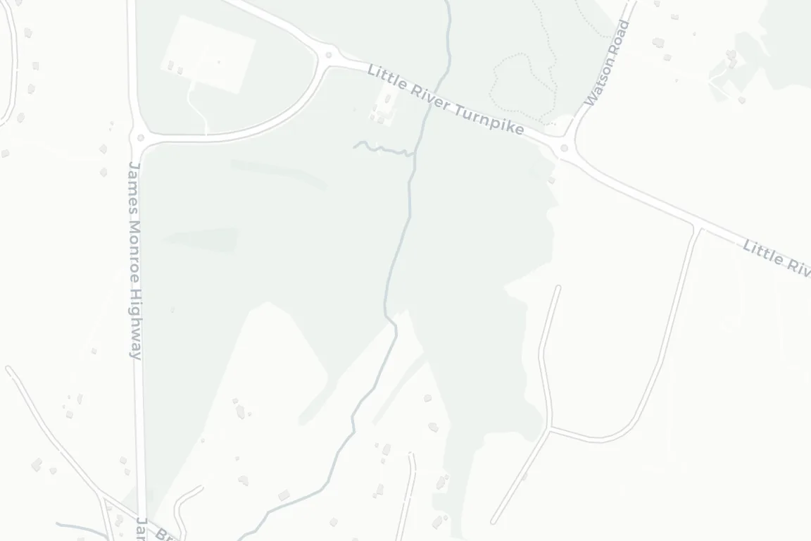
The parcel layer. It helps connect a site to jurisdictions, local documents, comparable outcomes, and the approval record around it.

THE SITE TAKES SHAPE

Before anything gets built, the site has to make sense.

Existing conditions, access, setbacks, stormwater, and neighboring uses — made explicit before the next diligence dollar moves.

What you're looking atAn existing shopping center and outparcel moving from site evidence to a proposed QSR test fit. The last three plates are illustrative downstream scenarios, not predictions or RealClear deliverables. RealClear works before the expensive commitment: the cited constraints and unknowns that determine whether the path deserves diligence.
Existing strip center and undeveloped outparcel
01 · Existing condition
The complete acquisition site outlined
02 · Entire site
03 · Site evidence
04 · Constraints
05 · Constraints labeled
06 · Illustrative development scenario
07 · Illustrative construction scenario
08 · Illustrative operating scenario
01 · Existing condition / The starting point

A working center. An untested outparcel.

The land is visible; the access, constraints, and development path are not.

QSR outparcel / shopping center
Existing strip center and undeveloped outparcel
01 · Existing condition
01 · Existing condition / The starting point

A working center. An untested outparcel.

The land is visible; the access, constraints, and development path are not.

The complete acquisition site outlined
02 · Entire site
02 · Site boundary / The whole acquisition

Start with the entire site.

The shopping center, frontage, access, and outparcel enter one shared frame.

Parcel evidence, access, frontage, utilities, and adjoining uses labeled
03 · Site evidence
03 · Site evidence / The record

The records land on the map.

Parcel, access, frontage, utilities, and adjoining uses become evidence instead of assumptions.

Setback, access, stormwater, buffer, and buildable-area constraints drawn on the site
04 · Constraints
04 · Constraints / The site pushes back

The usable ground gets smaller.

Setbacks, stormwater, buffers, and access geometry define the real development envelope.

The site constraints with plain-language labels
05 · Constraints labeled
05 · Labeled constraints / The decision frame

Every limiting condition gets a name.

The team can see what is fixed, what is uncertain, and what still needs an answer.

An illustrative quick-service restaurant test fit with parking, shared access, and drive-through circulation
06 · Illustrative development scenario
06 · Illustrative downstream scenario / Not a forecast

One possible QSR test fit.

This downstream visual is illustrative—not a predicted entitlement outcome or a RealClear deliverable.

An illustrative construction scenario for the quick-service restaurant test fit
07 · Illustrative construction scenario
07 · Illustrative downstream scenario / Not a forecast

If the project advances, construction could follow.

This downstream visual is illustrative—not a construction prediction, approval claim, or RealClear deliverable.

An illustrative operating scenario for a quick-service restaurant within the existing retail site
08 · Illustrative operating scenario
08 · Illustrative downstream scenario / Not a forecast

One possible operating configuration.

This downstream visual is illustrative—not a predicted operating asset, promised outcome, or RealClear deliverable.

04 · WHAT WE ANSWER

Five questions every site must answer. Cited inside every run.

How to read this“Retired” means the memo answers that question with cited evidence — an unknown becomes a documented finding you can hand to committee. The risk itself stays yours to underwrite; the memo makes sure you underwrite it with the record in hand.
1Is it by-right — or does the code say otherwise?ZONING UNKNOWN RETIRED
2Who can stop it, and at which veto point?PROCESS UNKNOWN RETIRED
3What does the local record already show?OPPOSITION SURPRISE RETIRED
4What happened when others tried here?PRECEDENT UNKNOWN RETIRED
5What still needs a professional answer?HANDOFF MADE EXPLICIT

Each question retired at screening is a line item you don't pay to rediscover mid-diligence — priced below.

05 · WHAT IT SAVES

What the approval path does to the pro forma.

One data-center site saw a $1 billion planned investment withdrawn after the record turned. The signals were in the public record the whole time.
Moratoriums don't announce themselvesthe week you close. They're written into the record months before.
How to read thisSame finding, three discovery moments — the later it surfaces, the more it costs.
WHAT AN APPROVAL FINDING COSTS — AND WHEN YOU FIND OUTILLUSTRATIVE FIGURES ARE LABELED
The finding
Discretionary rezoning
Not by-right: a legislative act with public testimony and political review — plus a second veto point behind it.
The calendar DOCUMENTED · CASE FILES
6–36 months
The range documented across our case files. Franklin Township burned 183 days just reaching withdrawal.
The spend at risk ILLUSTRATIVE RANGE
$50K–$260K
Per-site diligence spend at risk — counsel, civil, utility, consultants — before the first veto point even votes.
Sensitivity band — when the same finding surfaces

Franklin Township, priced: by withdrawal — 183 days after filing — the sunk cost spanned land assembly across roughly 470 acres, partner-rate attorney fees, and roughly a year of senior-team time from first assembly to walk-away, on a path the public record had flagged as steep from the start.

ILLUSTRATIVE BRIDGE · IN A DELIVERED MEMO, EVERY GROUNDED FIGURE CARRIES ITS SOURCE; UNGROUNDED FIGURES ARE LABELED ILLUSTRATIVE

✳ analyst's note — the arithmetic is not the recommendation; it is why the recommendation is worth reading.

THE FINDING IS CHEAPEST AT SCREEN

Request access

MULTIFAMILY · THE DECISION BEFORE THE SPEND

Every finding has a clock and a cost.

On a multifamily infill site, setbacks, access, and approval history belong on the table before design and entitlement spend begins.

06 · WHAT'S UNDERNEATH

It looks like a search box. It works like a research system.

A chat window answers from memory. RealClear answers from the record.

THE SYSTEM UNDERNEATHEVERY PIECE CHECKABLE
M·1Five layers, read in parallel

A zoning reader, a pathway mapper, a community sentinel, a comparable analyst, and a report writer work the record at once, with live research from the open web.

M·2Nothing ships uncited

Every assertion must name a source document before it leaves the building — bound, in the database, to the exact source it came from. A claim without a citation isn't softened — it's blocked.

M·3A living map of the public record

Underneath sits a knowledge graph — a living map of the record, cross-referenced so the same ordinance, staff report, or filing is findable from every site it touches. Every run deepens it.

M·4One clear read at the end

Advance, Hold, or Kill — and every reason behind it opens to its source.

How you give us the siteAn address is a point. A drawn boundary is a site.
GIVE US THE SITE · WORKED EXAMPLE
Ashburn Expansion · 72 ac · Loudoun County, VARequest access

Start with an address, a parcel number — or draw the boundary yourself. The research reads the record either way.

Whether the next diligence dollar is worth spending — a reviewed, cited site memo. Target: a delivery window confirmed at acceptance of the completed property submission. Complex or thin-record sites can take longer.

A chat window can sound certain. It can't hand you the source. The difference isn't a better answer — it's an answer your counsel can check.

DATA CENTERS · UNKNOWNS HELD, NOT GUESSED

Unknowns are held. Never guessed.

Power, water, zoning, and local opposition are separated into sourced facts, open questions, and next checks — never filled in with confidence.